Lake Atitlan's Xocomil Wind: What It Is and How to Plan Your Visit
21 June 2026 · Atitlan GT
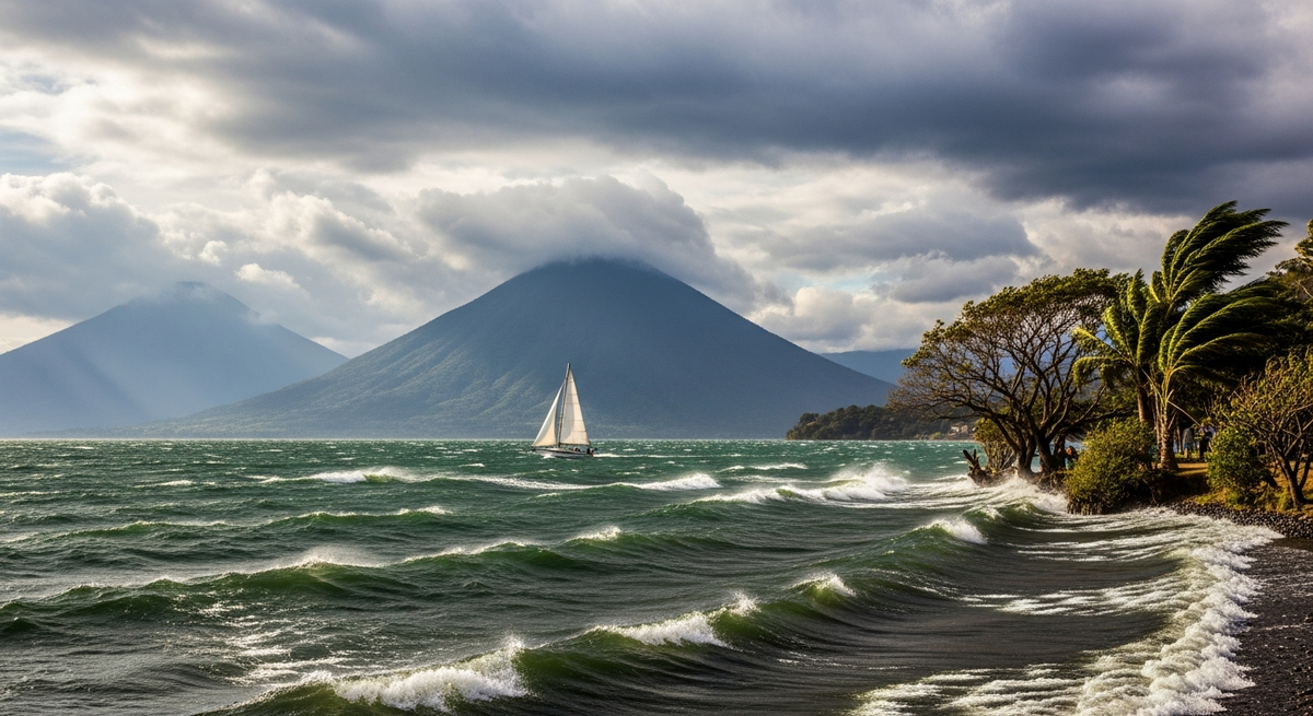
If you've ever visited Lake Atitlán after midday and seen the calm morning waters turn into strong, windy waves, you've experienced the Xocomil. In the Tz'utujil language, Xocomil means "the wind that sweeps away sins." It's a unique meteorological phenomenon of the lake, and understanding it is key to planning your visit well.
What is Xocomil?
Xocomil is a thermal wind that occurs every afternoon on Lake Atitlán, generally between 1:00 and 5:00 PM. It originates when warm air from the Pacific rises through the ravines and volcanoes to the south, collides with cold air from the north of the lake, and creates a wind system that can reach 80 km/h at its peak.
How It Affects Activities on the Lake
Boat services between towns are often suspended or reduced between 1-5 PM on days with strong Xocomil. Kayaking and SUP are impossible in strong winds. Morning activities (6-12 PM) are highly recommended. The months of highest intensity are March–May.
How to Prepare for Xocomil


Trip Planning with Xocomil in Mind
Schedule boat tours and water activities in the morning (before midday). Book boats that depart before 12 PM to ensure return. Hotels with terraces or lake views offer the spectacle of Xocomil from a safe spot with a drink in hand.
Frequently Asked Questions
Is Xocomil dangerous?
For small boats, it can be dangerous on days of extreme wind. Local boatmen know the lake and generally do not go out if the wind is risky. Trust their judgment.
Does Xocomil blow every day?
Not every day, nor with the same intensity. In the dry season (November–April) it is more predictable. In the rainy season, it can be more variable.
For more information on weather and activities, read our guide to kayaking in Bahía de Atitlán and the best sunrises on the lake.
As an Amazon Affiliate, I earn from qualifying purchases. The price you pay does not change.