Map of Lake Atitlán: villages and how to get around by boat
16 July 2026 · Diego Monzón
Add us as a preferred source on Google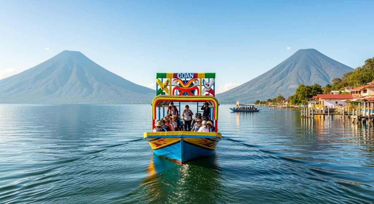
Lake Atitlán, in the department of Sololá, isn't a single destination: it's a ring of Mayan villages scattered around a lake of volcanic origin, each with its own character. Reading it like a map —who sits where and how to hop from one to the next— is the key to not wasting time or money. In this guide I'll walk you through how the villages are laid out, where the central hub is, and how to move between them by public boat.
How to get around Lake Atitlán
The most practical and cheapest way to travel the lake is the public boat ("lancha"), with fares between Q10 and Q25. Panajachel works as the central hub: almost everyone arrives there first, and the collective boats to the rest of the villages leave from its dock. Picture the lake as a clock face and Panajachel as the entry gate in the northeast.
Collective boats don't run on a strict timetable: they leave when they fill up, roughly every 20 to 30 minutes during the day. You pay the boatman on board or as you step off, always in quetzales and with small bills. To get around inside each village there are tuk-tuks, dirt cheap for climbing the cobbled hills.
The map: where each village sits
The lake is about 18 km long by 8 km wide, so distances are manageable. The three volcanoes —Atitlán, Tolimán and San Pedro— tower over the southern shore. Here's the general layout, starting from the hub and going around the water:
- Panajachel (northeast) — the entry hub, with the best road connection and the main dock.
- Santa Catarina Palopó (east) — a village of brightly painted houses, a few minutes from Pana by land.
- San Antonio Palopó (east) — beyond Santa Catarina, known for its pottery and farming terraces.
- Santiago Atitlán (south) — the largest and most traditional Tz'utujil village, at the foot of the volcanoes.
- San Pedro La Laguna (southwest) — lively and backpacker-friendly, at the base of the San Pedro volcano.
- San Juan La Laguna (west) — San Pedro's neighbor, famous for its hand-dyed textiles and calm vibe.
- San Marcos La Laguna (northwest) — the wellness village, home to yoga and cliff jumping off the rocks.
- Tzununá and Jaibalito (north) — tiny villages between San Marcos and Santa Cruz, reachable almost only by boat.
- Santa Cruz La Laguna (north) — next to Panajachel by water, with lakeside hotels and a steep village above.
Boat routes and docks
There are two main boat "lines" from Panajachel. The northern route hugs the shore and stops at Santa Cruz, Jaibalito, Tzununá and San Marcos before reaching San Pedro. The direct route crosses the lake straight to San Pedro with fewer stops. Santiago Atitlán has its own boats, also leaving from Pana's dock.
Panajachel has more than one dock: the one on Rancho Grande street is usually for the northern route (Santa Cruz, San Marcos) and the one at the end of Santander street for Santiago and San Pedro. If you're unsure, just ask "where does the boat to [village] leave from?" — locals will point you right away.
Tips so you never get lost
The last boat usually leaves around 5 or 6 p.m.; after that, prices go up and options shrink, so don't save your crossings for after dark. Agree on the fare before boarding if the boatman doesn't state it, to avoid the "tourist price." And if you're staying several nights, choosing your base well saves you crossings: check our guide on where to stay in Panajachel if you want the best-connected village as your starting point.
Frequently asked questions
How do I get around the villages of Lake Atitlán?
The most common and cheapest way is the public boat (or "collective lancha"). They leave from the docks in Panajachel, San Pedro, Santiago and other villages, working almost like a water bus: you hop on, pay the boatman, and get off at the dock you need. There are also tuk-tuks to move around within each village, and roads to a few of them like Santiago and San Pedro.
How much does the boat cost on Lake Atitlán?
Public boat rides cost between Q10 and Q25 depending on distance. Short hops (for example Panajachel to Santa Cruz or Jaibalito) are at the low end, and crossing the whole lake to San Pedro or San Marcos at the high end. Bring cash in quetzales and small bills.
Which is the central village of Lake Atitlán?
Panajachel is the hub or central point of the lake. It's the largest village and the best connected by road from Antigua and Guatemala City, and its dock is the main departure point for boats to the rest of the villages.
How long does it take to cross the lake by boat?
Crossing from one end to the other (for example from Panajachel to San Pedro La Laguna) takes between 25 and 45 minutes, depending on the waves and how many docks the boat stops at along the way. Short trips between neighboring villages are just 5 to 15 minutes.
Are there roads between the lake's villages?
Only some villages are connected by road, such as Panajachel, Santiago Atitlán, San Lucas Tolimán and San Pedro La Laguna. Many others —Santa Cruz, Jaibalito, Tzununá, San Marcos— are far quicker and easier to reach by boat than by land, and some are practically only accessible by water.