Where Is Lake Atitlán? Department and Location
16 July 2026 · Diego Monzón
Add us as a preferred source on Google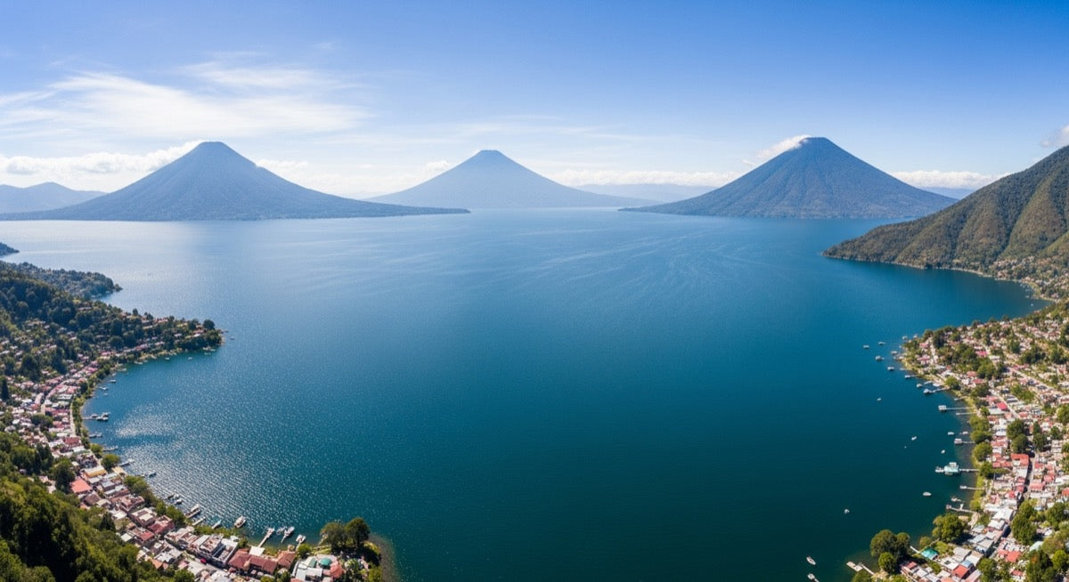
If you're planning your trip and wondering exactly where Lake Atitlán is, the short answer is clear: in the department of Sololá, in the western highlands of Guatemala. But being able to place it on the map —and understanding how to get there— completely changes how you plan your route. In this guide we give you the full mental map: department, altitude, coordinates, distances from the most common entry points, and the towns that surround its waters.
Which department and region is Lake Atitlán in?
Lake Atitlán is in the department of Sololá, in the region of the western highlands of Guatemala. The departmental capital, the town of Sololá, sits in the mountains just above the northern shore, while the tourist towns are spread around the coastline. Its approximate coordinates are 14.7° N, 91.2° W, placing it in the mountainous heart of the country, west of the capital and northwest of the Pacific coast.
The lake fills a volcanic caldera formed by the super-eruption known as "Los Chocoyos" some 84,000 years ago. That origin explains its dramatic shape and the three volcanoes guarding it: Atitlán (3,537 m), Tolimán (3,158 m) and San Pedro (3,020 m). It is also the deepest lake in Central America, at about 340 m maximum depth.
Exact location: altitude, size and coordinates
The lake's surface sits at about 1,562 meters above sea level (5,125 feet), an altitude that gives it an eternal-spring climate, with temperatures around 15–25 °C. It covers roughly 130 km², about 18 km long and 8 km wide. Its name comes from the Nahuatl atitlan, meaning "between the waters" or "place where water abounds".
| Fact | Detail |
|---|---|
| Department | Sololá, western highlands |
| Altitude | ~1,562 m (5,125 ft) |
| Approx. coordinates | 14.7° N, 91.2° W |
| Surface area | ~130 km² (18 km × 8 km) |
| Max depth | ~340 m (deepest in Central America) |
| Origin | Volcanic caldera ("Los Chocoyos", ~84,000 years) |
How far is it and how do you get there?
Lake Atitlán is very accessible from Guatemala's main entry points. Most travelers first arrive in Panajachel, the gateway to the lake, and from there take a public boat to the rest of the towns.
- From Guatemala City: around 3.5 hours by car or shuttle along the Inter-American Highway (CA-1).
- From Antigua Guatemala: roughly 3 hours by direct tourist shuttle.
- Around the lake: public boats (Q10–25) connect the towns; tuk-tuks help you get around within each village.
The dry season (November to April) is the best time to travel, with clear skies that reveal the three volcanoes; November through February usually offer the sharpest views.
The towns that surround the lake
Around the lake there are a dozen municipalities and villages, each with its own personality and, in many cases, its own Mayan language (Kaqchikel, Tz'utujil and K'iche' are spoken). Among the most visited are Panajachel (the transport and services hub), Santiago Atitlán, San Pedro La Laguna, San Marcos La Laguna, San Juan La Laguna, Santa Cruz La Laguna, San Antonio Palopó, Santa Catarina Palopó, and the quieter villages of Jaibalito and Tzununá.
If Panajachel is your base, there's plenty to explore as soon as you arrive: check out our guide on what to do in Panajachel to make the most of your first day. And to decide which town to stay in based on the vibe you're after, take a look at our picks for where to sleep at Lake Atitlán.
Frequently asked questions
In which department is Lake Atitlán located?
Lake Atitlán is located in the department of Sololá, in the western highlands of Guatemala. The departmental capital, the town of Sololá, sits in the mountains just a few kilometers from the shore.
How high is Lake Atitlán?
The lake's surface sits at about 1,562 meters above sea level (5,125 feet). That altitude gives it an eternal-spring climate, with daytime temperatures usually between 15 and 25 °C.
How many hours is Lake Atitlán from Guatemala City?
By car or shuttle, the trip from Guatemala City to Panajachel takes around 3.5 hours along the Inter-American Highway (CA-1). From Antigua Guatemala it's roughly 3 hours.
Which towns surround Lake Atitlán?
The best-known lakeside towns include Panajachel, Santiago Atitlán, San Pedro La Laguna, San Marcos La Laguna, San Juan La Laguna, Santa Cruz La Laguna, San Antonio Palopó, Santa Catarina Palopó, Jaibalito and Tzununá.
How do I get to Lake Atitlán from Antigua?
The easiest way is a direct tourist shuttle from Antigua to Panajachel, which takes about 3 hours. Once in Panajachel, public boats (Q10–25) connect you to the rest of the towns around the lake.